
Cartes géographiques
Date de sortie
- tous
- publiés
- 43 moins de 3 mois
- 18 moins d'un mois
- 6 moins d'une semaine
Disponibilité
Prix
-

-
 Carte nationale de la Suisse, 1203, YVERDON LES BAINSXxxOffice Fédéral de Topographie Russe – OFTS14,30
 -

-
 Carte nationale de la Suisse, 1230, **GUTTANNEN*XxxOffice Fédéral de Topographie Russe – OFTS13,55
 -

-
 Carte nationale de la Suisse, 241, VAL DE TRAVERS PONTARLIER - STE CROIX - FLEURIERXxxOffice Fédéral de Topographie Russe – OFTS14,30
 -
 Carte nationale de la Suisse, 1182, STE CROIX 1/25 000XxxOffice Fédéral de Topographie Russe – OFTS14,30
 -
-

-

-

-
 Top 25 : une carte, un site, 2644OT, 2644Ot Pezenas-Murviel-Les-BeziersXxxIGN – Institut Géographique National13,90
 -

-

-
 Top 25 : une carte, un site, 2447OT, 2447Ot Tuchan.Massif Des CorbieresXxxIGN – Institut Géographique National13,90
 -
 Top 25 : une carte, un site, 2643ET, 2643Et Clermont-L'HéraultXxxIGN – Institut Géographique National13,90
 -
-
 Top 25 : une carte, un site, 2347OT, 2347Ot Quillan.Alet-Les-BainsXxxIGN – Institut Géographique National13,90
 -
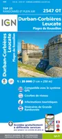 Top 25 : une carte, un site, 2547OT, 2547Ot Durban-Corbières.Leucate.Plages Du RoussillXxxIGN – Institut Géographique National13,90
 -
 Top 25 : une carte, un site, 2344ET, 2344Et Montagne Noire (Est).Mazamet.Pnr Du Haut-LaXxxIGN – Institut Géographique National13,90
 -
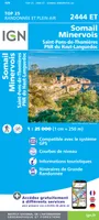 Top 25 : une carte, un site, 2444ET, 2444Et Somail.Minervois.Saint-Pons-De-Thomieres.PnXxxIGN – Institut Géographique National13,90
 -
 Top 25 : une carte, un site, 2343ET, 2343Et Castres.Le Sidobre.Pnr Du Haut LanguedocXxxIGN – Institut Géographique National13,90
 -
![Série bleue [nouveau format], 2446SB, 2446Sb Capendu/Ferrals-Les-Corbieres](//cdn.leslibraires.fr/d-2qDcyvw2GhOSxSM2JXagmmbd-eCxXAARgC8lO1qRE/s:200:200/MTE4MTM3Mzc.webp) Série bleue [nouveau format], 2446SB, 2446Sb Capendu/Ferrals-Les-CorbieresXxxIGN – Institut Géographique National13,90
Série bleue [nouveau format], 2446SB, 2446Sb Capendu/Ferrals-Les-CorbieresXxxIGN – Institut Géographique National13,90 -


![Série bleue [nouveau format], 2446SB, 2446Sb Capendu/Ferrals-Les-Corbieres](http://cdn.leslibraires.fr/d-2qDcyvw2GhOSxSM2JXagmmbd-eCxXAARgC8lO1qRE/s:200:200/MTE4MTM3Mzc.webp)
